Showing posts with label Long Trail. Show all posts

Friday, November 16, 2012

Hiking the Long Trail continued: Hiking around Griffith Lake


Copyright 2010, Green Mountain Club

Hello again! I've fallen far behind in updating the blog, so we're going to take a trip in the wayback machine back to the halcyon days of fall. Sections (5) and (6), surrounding Griffith lake, were really quiet and pretty. The first half included a hike up Baker peak, which was a refreshingly breezy. Once at Griffith Lake, I took a path called Old Job trail on the map, which wound up being part of a system snowmobile trail that crosses the state.  


The snowmobile trail bypassed Baker peak and was quite flat. Unfortunately, an entire stretch of it had been washed away by the nearby creek during Hurricane Irene, and some of the otherwise flat hiking was turned into climbing.


The second section of the hike started at Mad Tom Notch, a long gravel road that was made a little sketchier by the heavy rain that had been falling for much of the week. It wasn't quite as fun as the first section, but seeing Griffith lake shrouded in fog was well worth the price of admission on its own.


More Pictures:
Turkey tail fungus


GPS Routes:

Friday, October 19, 2012

Back with more hiking (VT Rt. 140 to USFS 10)

(Copyright 2010, Green Mountain Club)


Hi guys! I guess it's been a while, but I got a little busy, and wanted to post sections up in proper order. So what happened is this: I did section 4 real quick after class one day (Constitution day, actually), remembered the section and decided to save the other half of it (Section 7) for a few weeks until my girlfriend made it up. Then we would hike the 13 miles together during peak leaf season. Both hikes start at a road, go to Little Rock Pond, take the loop around the pond, and then go back to my car.


The first section, which was only 5 miles out and back, was  very easy. See for yourself on the map. Almost table-flat. It was a really pretty hike, though, particularly the lake, so I knew that I had to save the connecting hike for 2 weeks.


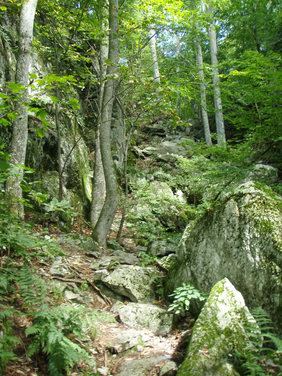
Fast forward two weeks...my girlfriend is up to visit and leaf-peep. We got kind of a late start on the hike (I think we started around 11), packing sandwiches and GORP for an even later lunch. We also started at a parking lot that cut off .4 miles. Having done it before, I'm fine with this. So up White Rock Mountain we went. We got to the White Rocks, a creepy place where people have built hundreds of cairns.


We then did something completely foreign to me- we hiked .2 miles off the trail (and back downhill) to a vista. It was probably worth it. We had pretty good weather all day, and avoided the rain we had a chance of getting. It had rained the night before, though, so a lot of the trail was pond-like after we got out of the high spruce/fir forests.


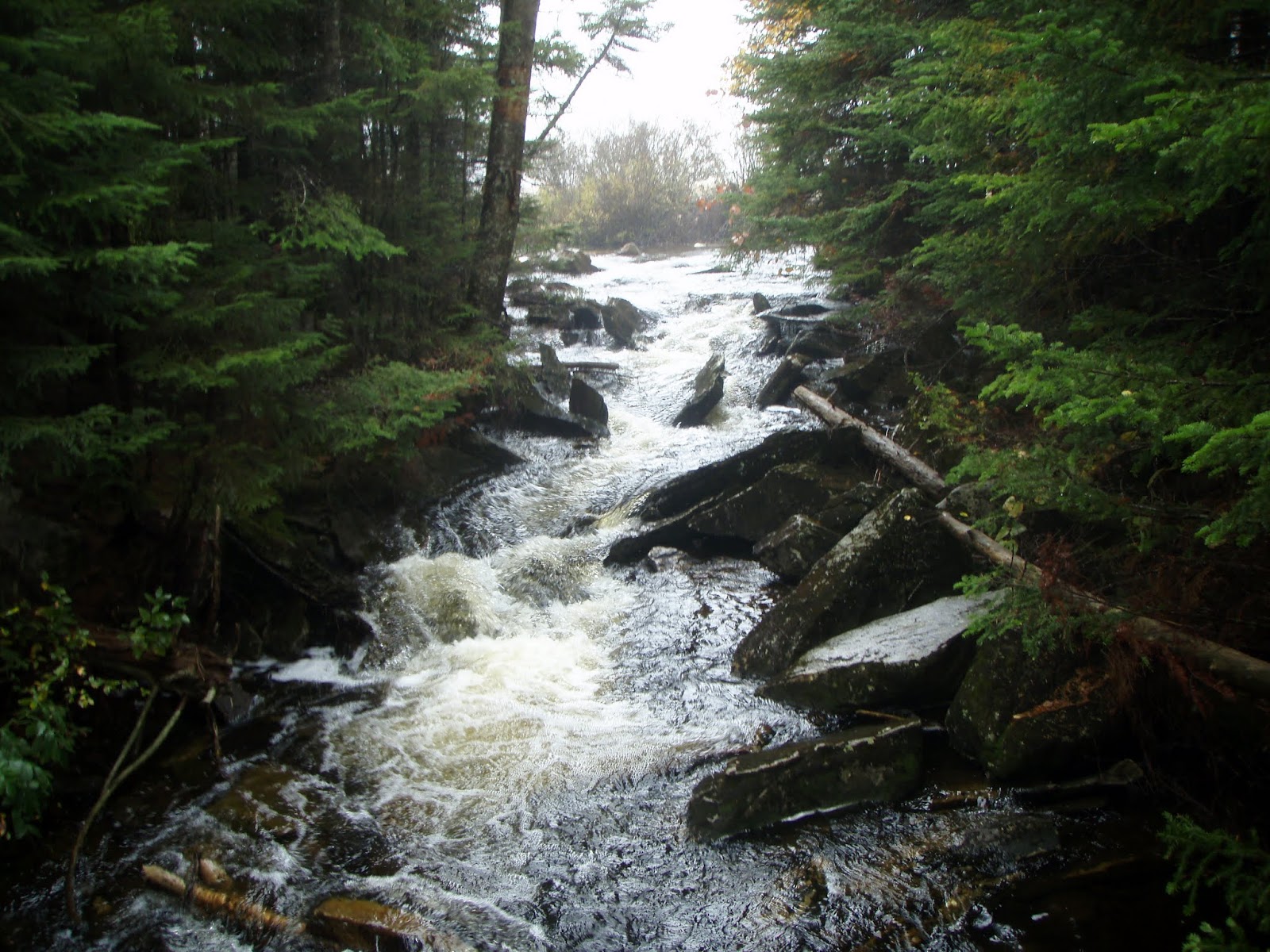
We finally go to the Pond around 2:30, scrambled up a rock that had some great views, and tucked into some grilled avocado sandwiches. It was a pretty good way to spend an afternoon. We kind of had to rush back on the 2nd half to beat sundown, but overall it was an amazing hike.


One thing I particularly enjoyed about the hike (besides the girlfriend) was seeing what a difference 2 weeks makes on a trail. The idea of being in the same place two different times is kind of foreign to thru-hikers, at least, and I don't remember what the air smelled like or how the breeze felt 4 years ago when I was doing that section.
More Pictures:
 

(compare/constrast:)


Pictures of the same spots from the AT 4 years ago:
I don't have my journal from the AT with me, but what I remember about this section was being creeped out by the White Rocks, and asking the caretaker at the Little Rock Pond shelter where I stayed one night what she thought of Joe Biden (she was from Delaware and it was election season 2008).


GPS Routes:
Rt. 140 to Little Rock Pond
USFS to Little Rock Pond

Monday, September 10, 2012

Hiking the Long Trail- "One Piece At a Time"


The middle chunk was last week's hike.
(Also from GMC's maps, Copyright 2010)

So one of the challenges with sectioning the Long Trail is that you have a car you have to come back to, which means that hiking tends to start and end in parking lots, and creativity is required in figuring out how much to hike. Hiking it piecemeal lets you try some different things, too. My beloved Vasques are kind of falling apart, so I brought along my runners and tried to up the pace a little bit.


One does not simply run through Vermont


The first section, a 1 mile scramble up to the Clarendon Shelter, was what we meant to do last week, and was not really suitable for running. It was fun, though, and the weather was a perfect 75 degrees, so I had no complaints.


Typical Lowland Maple/Beech/Birch Forest

The next section was a 3.3 mile hike over Bear Mountain (one of 11 Bear mtns in the state, and one of about 50 on the A.T.) and to the shelter my girlfriend and I stopped at going south last week. I got a little bit of running in here, but probably just 2 miles. The uphill was a lot of slick stone steps (it poured down rain the night before), the flat spots were similarly muddy, and the downhill consisted of switchbacks cut into the mountain (running down which would be like gunning a truck down Lombard street). Still a great time to clear my mind and enjoy the fleeting weather. I did not follow through with my plan to jump in a nearby river to cool off afterwards, however.


More Pictures:

Tiny King Boletus


Yeah. Eft you, pal!


GPS Routes:
103 to Clarendon Shelter

Friday, September 7, 2012

Calvin Coolidge and a little hiking


The Bridge of Death!

My girlfriend came up to visit last week. This is an account of some of our adventures (not included: watching Hook, seeing Joseph Smith birthplace, driving around). The first day we were near Rutland visiting friends (and an adorable baby), so we were going to knock out that one mile from the Clarendon Shelter to rt. 103. I can't read a map and we wound up going in the other direction, over Clarendon gorge and to the Minvera Hinchey shelter (2.7 miles, ~'1000 feet). Getting over the gorge required going over a wobbly suspension bridge, which required the boyfriend rocking it back and forth, Temple of Doom-style ("Hang on lady, we going for a ride!"- Short Round).

We scrambled up the hill, watched some birds and planes fly around the Rutland airport, and kept hiking. Eventually I figured out that I'd made a mistake in my navigation, and we decided to keep going and go 5.2 miles.

We had a good day for being outside

The next day we decided to get our nerd on and go to the Calvin Coolidge State Historical Site. The big parking lot was so full that cars (from Tennessee, Arizona, California...) were parked in the grass. I don't feel quite that strongly about President Coolidge either way. I don't really know that much meaningful about him: his wife Grace basically masterminded his rise to power and he was sworn in by his father in Vermont after Harding was murdered by his wife. Also, his Vice President, Charles Dawes, won the Nobel Prize and had a son named Rufus Fearing Dawes, who drowned in a lake. We eschewed the crowded historical site for Plymouth Notch Cemetery, where Coolidge and his wife (and about 60 other Coolidges) are buried. I had heard good reviews of the place, and it lived up to its billing as a gorgeous old cemetery. We also overheard some older folks swapping stories about all of the presidential burial sites they'd seen. Apparently some people make a serious effort to see every site (and probably root for people like Jimmy Carter to "go ahead and die, already"). This seems like a worthwhile way to spend one's retirement.


On the way back from Plymouth, we went by Quechee Gorge. We walked about a mile across the bridge and then down under it. Then we drove home and ate some cake.


More Pictures: